Flood Watch Expands
Flood Watches Expanded for Heavy Rain and Potential Flash Flooding in Hudson Valley, Central PA
Anonymous
Key Points
1
In the Hudson Valley, the National Weather Service has issued a flood watch for all of Dutchess and Ulster counties, plus parts of eastern Connecticut, from late Sunday to Tuesday morning, with forecast rainfall of 1 to 3 inches. Meteorologist Brett Rathburn noted that, due to drought conditions, rivers aren’t expected to overflow, but localized minor river flooding could occur from overwhelmed drainage systems.
2
Park and infrastructure impacts from the weekend storms include Bear Mountain State Park in southern Orange County and James Baird State Park in Pleasant Valley being closed indefinitely due to storm damage, with a water main break at Bear Mountain; East Fishkill reported more than a dozen roadways partially closed, and tens of thousands of customers in the Hudson Valley remained without power.
3
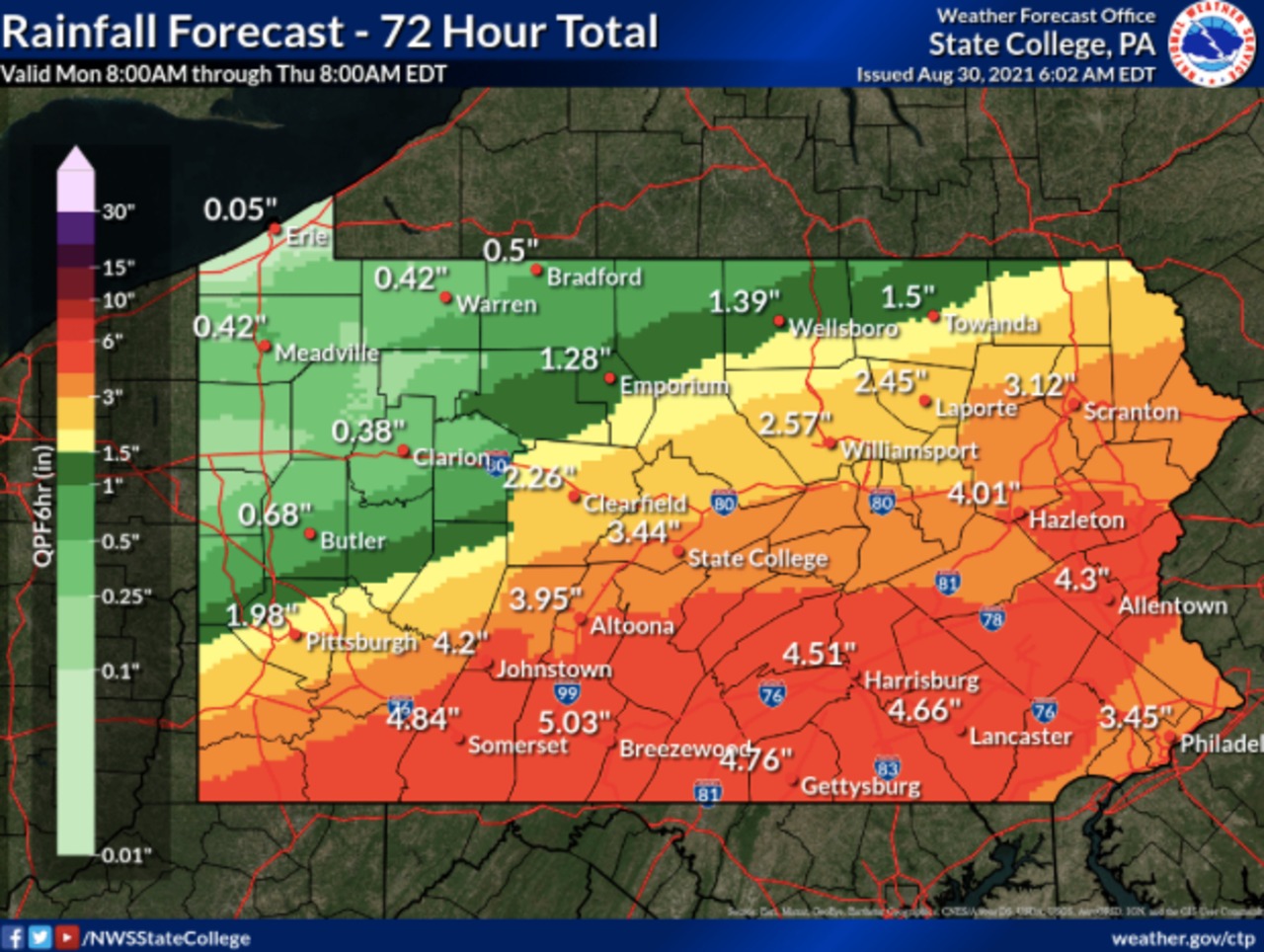
Lancaster County is under a flood watch from 2 p.m. Sunday to 8 p.m. Monday, with forecasts of 1–2 inches of rain Sunday night; initial storms left thousands without power, signaling a potential repeat of power outages as storms move through central Pennsylvania.
4
The weather outlook includes a convective risk: the Storm Prediction Center shows a slight risk (2 on a 1–5 scale) for severe storms this period, with late-afternoon development in western counties and the potential for damaging winds, heavy rain, and even hail.
5
In the Lehigh Valley, forecasters warn of the greatest threat for storms along the Interstate 78 corridor southward, with rain beginning after 2 p.m.; expected rainfall includes a half- to three-quarters of an inch in some areas and up to 1–3 inches in others.
Flood watches have expanded across the Hudson Valley, central Pennsylvania, Lancaster County, and the Lehigh Valley as a powerful weekend storm system pushes heavy rain through the Northeast. WTAE reports that conditions are expected to keep deteriorating into the workweek, with daily chances for showers and storms lingering through Monday and beyond.
Rainfall totals could reach 1 to 3 inches across the hardest-hit areas. The Storm Prediction Center has flagged a slight risk — a 2 on a 1-to-5 scale — for severe storms, including damaging winds and hail. Residents are urged to avoid unnecessary travel during peak storm periods.
Hudson Valley Hit Hard by Storm Damage and Outages
The National Weather Service issued a flood watch for all of Dutchess and Ulster counties, plus parts of eastern Connecticut. The watch runs from late Sunday through Tuesday morning. Forecasters expect 1 to 3 inches of rain across the region.
Meteorologist Brett Rathburn noted that drought conditions mean rivers are unlikely to overflow their banks. But overwhelmed drainage systems could still cause localized minor river flooding. Two state parks — Bear Mountain in Orange County and James Baird in Pleasant Valley — were closed indefinitely due to storm damage. A water main break was reported at Bear Mountain. East Fishkill saw more than a dozen roadways partially closed, and tens of thousands of customers remained without power across the Hudson Valley.
Lancaster and Central PA Brace for Round Two
Lancaster County is under a flood watch from 2 p.m. Sunday through 8 p.m. Monday. Forecasters expect 1 to 2 inches of rain Sunday night alone. The initial round of storms already knocked out power for thousands of residents, raising concern about a repeat as the next wave moves through.
WTAE reports most of Western Pennsylvania is also under a flood watch, with conditions expected to worsen further into the week. Urban streets and low-lying areas face the greatest flood risk as drainage systems struggle to keep up with fast-moving downpours.
Lehigh Valley Faces Storms Along the I-78 Corridor
In the Lehigh Valley, forecasters say the greatest storm threat runs along the Interstate 78 corridor southward. Rain is expected to begin after 2 p.m. Sunday. Some areas could see half to three-quarters of an inch. Others could get 1 to 3 inches depending on storm track and intensity.
The combination of heat, humidity, and slow-moving storm cells is driving the risk. High moisture in the air fuels intense downpours and flash flooding. Forecasters warn that even areas not under a formal watch should prepare for heavy rain and gusty winds during the afternoon and evening hours.
Northeast Ohio Also Under Flood Watch Through Sunday Night
The flood threat extends beyond Pennsylvania and New York. Indeonline reports that the National Weather Service issued a flood watch for parts of Northeast Ohio — including Medina, Portage, Stark, and Summit counties — through 10 p.m. Sunday, July 5. Showers and thunderstorms are expected to bring heavy rain to those areas as the same regional system pushes through.
Canton Rep confirmed the same watch, noting that the threat is tied to the broader storm system sweeping across the region. Officials across all affected areas are asking residents to stay informed, monitor local alerts, and have a plan ready if flooding develops quickly near their homes or roads.
Sentiment
Mostly NegativeNEGATIVENEUTRALPOSITIVE
Publishers
20
Articles
11
Reach
31
A
AnonymousAuthor


