Mindanao Quake
5.8 Magnitude Offshore Quake Strikes Mindanao; No Damage or Tsunami Warning Issued
Anonymous
Key Points
1
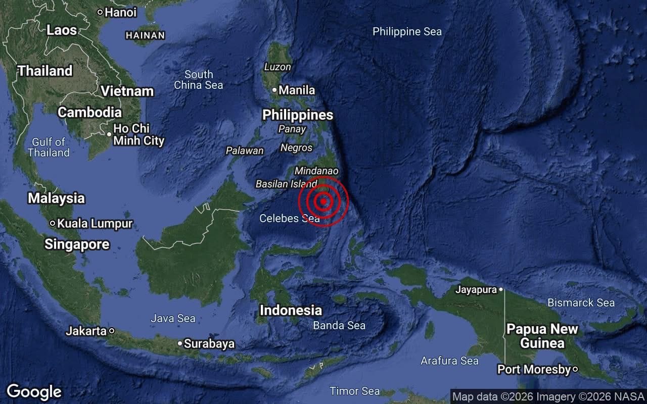
Phivolcs described the 5.8 offshore quake as an aftershock of June’s offshore magnitude-7.8 Sarangani event and the magnitude-6.5 offshore Davao Occidental quake, with the quake occurring around 4:11 p.m. local time about 63 kilometers southeast of Balut Island.
2
Epicenter and depth varied by agency: GFZ (and Phivolcs) placed the event at about 10 km depth near Balut Island/Sarangani, while EMSC reported an epicenter about 49 km north of Sarangani at a depth of 35 km.
3
Local shaking included Intensity 4 felt by residents of Sarangani; instrumental Intensities II were recorded in Kiamba, Malungon, and General Santos City, with additional I readings in several other towns.
4
Magnitude was reported differently by agencies, with BMKG/VolcanoDiscovery listing 5.9, while GFZ recorded 5.8 and MetMalaysia logged 5.7.
A magnitude 5.8 earthquake struck off the southern Philippines on July 6, 2026, shaking parts of Sarangani and nearby towns, according to GFZ. The quake hit at a shallow depth of about 10 kilometres, around 4:11 p.m. local time. No tsunami warning was issued, and no significant damage or casualties were reported.
VolcanoDiscovery listed the magnitude slightly higher at 5.9, while MetMalaysia recorded 5.7. Despite the differences, all agencies agreed the event posed no major threat. The Philippine Institute of Volcanology and Seismology, known as Phivolcs, confirmed the quake was tectonic in origin.
Phivolcs Links Quake to June's Major Sarangani Event
Phivolcs described the July 6 quake as an aftershock of two earlier events. The first was a magnitude-7.8 earthquake off Sarangani in June. The second was a magnitude-6.5 quake off Davao Occidental. The epicenter was placed about 63 kilometres southeast of Balut Island, according to GFZ.
Aftershocks are smaller quakes that follow a larger one in the same area. Phivolcs said authorities are continuing to monitor the area for further seismic activity. The Philippines sits on the Pacific Ring of Fire, a zone known for frequent earthquakes and volcanic eruptions.
Light Shaking Felt Across Sarangani and General Santos
The quake produced Intensity 4 shaking for some residents of Sarangani. Phivolcs recorded instrumental Intensity II in Kiamba, Malungon, and General Santos City. Several other towns logged Intensity I, meaning the shaking was weak but detectable by instruments.
Intensity 4 on the Phivolcs scale means the shaking is felt by most people indoors and can rattle dishes and windows. No structural damage was reported in any of the affected towns. Officials said there were no injuries.
Agencies Differ Slightly on Depth and Epicenter Location
Not all agencies placed the quake in exactly the same spot. GFZ put the depth at about 10 kilometres near Balut Island. The European-Mediterranean Seismological Centre, known as EMSC, reported the epicenter about 49 kilometres north of Sarangani at a depth of 35 kilometres. Shallow quakes tend to cause stronger shaking at the surface.
MetMalaysia confirmed the epicenter was about 171 kilometres south of Koronadal City and said the event posed no tsunami threat to Malaysia, according to BusinessToday Malaysia. Agencies typically measure earthquakes from different monitoring stations, which can lead to small differences in reported figures.
No Tsunami Risk, Monitoring Continues for Aftershocks
Authorities were quick to rule out a tsunami. MetMalaysia confirmed no threat to Malaysian coastlines. Phivolcs also issued no tsunami alert for Philippine shores. A magnitude 5.8 quake is generally not strong enough to trigger a tsunami unless it causes a large underwater landslide.
Officials said aftershocks were unlikely to be significant but warned the public to remain alert. The region has been seismically active following June's magnitude-7.8 event. Phivolcs said it would continue monitoring and urged residents to follow official guidance if further tremors occur.
Sentiment
Mostly NegativeNEGATIVENEUTRALPOSITIVE
Publishers
11
Articles
66
Reach
77
A
AnonymousAuthor


