Mexico Earthquake Alerts
7.4 Magnitude Offshore Earthquake Strikes Mexico, Prompting Tsunami Warnings Near Guatemalan Border
Anonymous
Key Points
1
In Oaxaca, Governor Salomon Jara said the earthquake was felt with moderate intensity in Oaxaca City, indicating broader regional impact beyond Chiapas.
2
Puerto Madero is described as a port and fishing town near the Guatemalan border, underscoring how close the epicenter was to international boundaries.
3
Coverage varied on the main tremor’s magnitude, with some outlets reporting 7.3 while others cited 7.4, reflecting early uncertainty in measurements.
4
Some reports noted that there was no tsunami threat elsewhere, with advisories limited to the region within about 300 kilometers of the epicenter.
A magnitude 7.4 earthquake struck off the coast of Mexico's Chiapas state near Puerto Madero on Monday, triggering tsunami warnings for coastal areas within 300 kilometers of the epicenter, according to Global News. The shallow quake — just 10 kilometers deep — sent shockwaves across the region, with buildings shaking as far away as Guatemala City and El Salvador.
The US Tsunami Warning System issued an alert for the coasts of Mexico and Guatemala, urging residents in low-lying areas to move to higher ground, The Daily Jagran reported. No widespread damage was immediately confirmed, but officials kept a close watch for follow-up waves and aftershocks.
Shallow Quake Near Guatemalan Border Rattles Region
The epicenter was located near Puerto Madero, a port and fishing town close to the Guatemalan border. A foreshock of magnitude 4.7 struck before the main event, according to KMPH. The main quake hit at 7:48 a.m. local time, southwest of Aquiles Serdán, Mexico. Early magnitude estimates ranged from 7.3 to 7.4, reflecting normal uncertainty in the first hours after a major quake.
In Oaxaca, Governor Salomón Jara said the quake was felt with moderate intensity in Oaxaca City, showing how far the shaking reached beyond Chiapas. Head Topics noted that Puerto Madero has in recent years been redeveloped with high-rise buildings and luxury hotels, making the proximity of the epicenter especially notable for local residents.
Tsunami Warnings Issued Across 300-Kilometer Coastal Zone
The US Tsunami Warning System put coastal communities within roughly 300 kilometers of the epicenter on alert, according to Newsy Today. Authorities urged people near the shore to evacuate and move inland. Officials stressed that no tsunami threat existed for areas farther away — the advisory was strictly regional.
Global News reported that buildings shook in Guatemala and El Salvador as the quake's energy spread south. Evacuations were carried out in coastal zones. Emergency teams monitored the shoreline for any sign of unusual wave activity in the hours following the main shock.
Cocos Plate Subduction Drives Chiapas Earthquake Risk
This region sits on the Pacific Ring of Fire, one of the most earthquake-prone zones on Earth. The quake was caused by the Cocos Plate pushing beneath the North American Plate — a process called subduction. That constant pressure builds enormous stress underground, which releases suddenly as earthquakes.
A depth of just 10 kilometers makes a quake especially dangerous. Shallow quakes release their energy close to the surface, causing stronger shaking and a higher risk of tsunamis. Mexico's Chiapas coast has a long history of major seismic events for exactly this reason, according to KMPH.
No Major Damage Reported, But Monitoring Continues
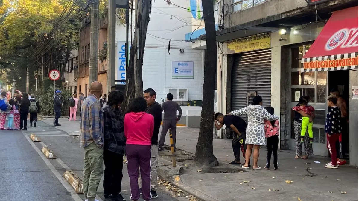
Despite the strong shaking, no widespread structural damage or casualties were immediately reported, The Daily Jagran noted. Authorities in Mexico and Guatemala remained on high alert. Emergency services were deployed to coastal areas to assist evacuations and check for any damage from shaking or waves.
Officials said they would continue monitoring wave data and seismic activity. Aftershocks were expected in the hours and days ahead. Residents in the evacuation zones were told to wait for official all-clear signals before returning to the coast, Global News reported.
Sentiment
Mostly NegativeNEGATIVENEUTRALPOSITIVE
Publishers
88
Articles
352
Reach
440
A
AnonymousAuthor


