Ramona Fire Evacuations
Creelman Fire Expands to 315 Acres, Prompting Ramona Evacuations and Civilian Rescues
Anonymous
Key Points
1
Creelman Fire expanded to about 315 acres and was 0% contained by 4:36 p.m., with evacuation zones including SDC-1168, SDC-1169, SDC-1242, SDC-1243, SDC-1244, SDC-1245 and SDC-1246; evacuation warnings were issued for zones SDC-1166, SDC-1167, SDC-1241, SDC-1246, SDC-1248 and SDC-1249.
2
Officials published an interactive evacuation map so residents could check in real time whether their address falls inside an active zone.
3
Two civilians were rescued from the area by helicopter as firefighters battled the Creelman Fire.
4
Evacuation boundaries were defined geographically: orders east of San Vicente Road and south of Creelman, extending north to State Route 78 and Old Julian Highway, with warnings surrounding San Vicente and nearby golf-area zones.
5
Road closures included Vista Ramona Road at Old Julian Highway and San Vicente Road at Wildcat Canyon Road.
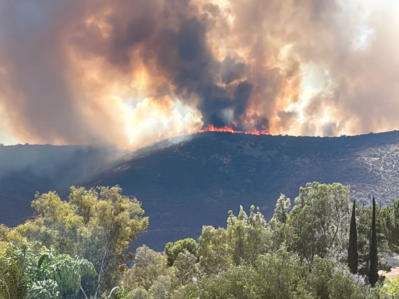
A fast-moving brush fire in Ramona, California, exploded to 315 acres on Tuesday with 0% containment, forcing hundreds of residents to flee their homes with little warning, according to Patch. The Creelman Fire ignited near 310 Creelman Lane and spread rapidly through dry brush, threatening structures and sending thick smoke into the sky above San Diego County.
Two civilians were rescued from the area by helicopter as crews scrambled to hold the fire's edge, Head Topics reported. A heat advisory was already in effect across the region, making conditions especially dangerous for both residents and firefighters.
Evacuation Orders Cover Seven Zones Around San Diego Country Estates
San Diego County Sheriff's Office issued mandatory evacuation orders for seven zones: SDC-1168, SDC-1169, SDC-1242, SDC-1243, SDC-1244, SDC-1245, and SDC-1246, according to Patch. These zones sit east of San Vicente Road and south of Creelman Lane, stretching north to State Route 78 and Old Julian Highway.
Evacuation warnings — one step below a full order — were issued for zones SDC-1166, SDC-1167, SDC-1241, SDC-1246, SDC-1248, and SDC-1249, covering areas near San Vicente and nearby golf-area neighborhoods. Officials published an interactive evacuation map so residents could check in real time whether their address fell inside an active zone, NBC San Diego reported.
Ramona High School Opens as Families and Animals Flee
A temporary evacuation point opened at Ramona High School for displaced residents, Rolling Out reported. Large animals had a separate designated site at the Ramona Rodeo, giving horse and livestock owners a safe place to bring their animals on short notice.
The fire left little time to prepare. Rolling Out described residents being forced to flee "without warning" as the blaze moved unpredictably through the area. Law enforcement increased its presence in affected neighborhoods as the situation remained volatile.
Road Closures Choke Key Routes Into Ramona Fire Zone
Authorities shut down Vista Ramona Road at Old Julian Highway and San Vicente Road at Wildcat Canyon Road, according to Head Topics. The closures cut off key entry points into the fire area, helping keep civilians out while giving fire crews room to work.
The Creelman Fire was not the only blaze burning in the region that day. The Rainbow Fire had already scorched about 35 acres in nearby North County earlier in the same day, Head Topics reported, underscoring how dangerous the conditions were across San Diego County.
Heat and Dry Conditions Drive Rapid Fire Spread
The Creelman Fire grew from a small brush fire to 315 acres in a matter of hours, with officials describing a "dangerous rate of spread" from the start. Dry vegetation and a regional heat advisory created ideal conditions for a fast-moving wildfire, Head Topics reported.
By 4:36 p.m., containment was still listed at 0%, meaning crews had not yet established a single defensive line around the fire's edge, according to Patch. Firefighters continued to battle the blaze as authorities urged anyone in warning or evacuation zones to leave immediately and not wait.
Sentiment
Mostly NegativeNEGATIVENEUTRALPOSITIVE
Publishers
15
Articles
11
Reach
26
A
AnonymousAuthor


