Atlantic System Tracked
National Hurricane Center Monitors Atlantic System with Very Low Development Chance
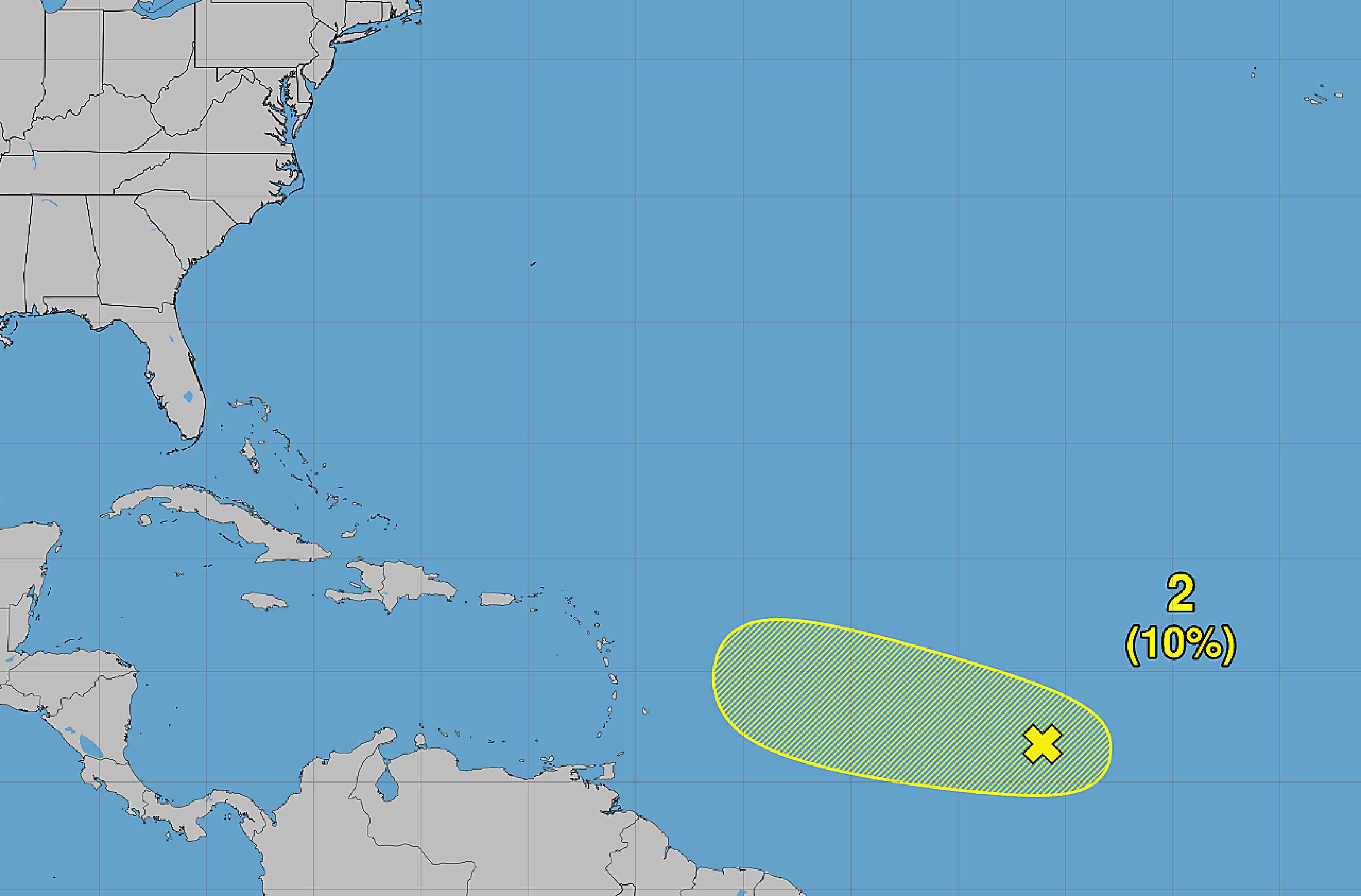
The National Hurricane Center is keeping an eye on a tropical wave in the Atlantic, but forecasters say it is unlikely to amount to much. The system, called Invest 94, carries only a 10% chance of developing into a tropical depression or named storm over the next two to seven days, according to Miami Herald.
The 2026 Atlantic hurricane season has been slow so far, producing only three named storms. Invest 94 sits near the Cape Verde Islands and the Caribbean's Lesser Antilles, where it shows disorganized showers and thunderstorms — a sign it is struggling to organize, Kansas City Star reported.
Invest 94 Faces Long Odds of Strengthening
Invest 94 is a tropical wave — a band of disturbed weather moving off Africa's coast. The NHC gave it just a 10% development chance over a week. That is a very low number. It means forecasters see little chance conditions will line up to let the system grow, according to BND.
Long-range computer models have shown a path that could bring tropical moisture toward Florida. But forecasters stress the system is not expected to become anything more than a rain-maker. It would need warm water, low wind shear, and better organization to pose any real threat, Star-Telegram noted.
2026 Season Has Been Quieter Than Expected
Only three named storms have formed so far in the 2026 Atlantic hurricane season. That is a slow pace. The peak of hurricane season runs from mid-August through mid-October, so there is still time for activity to pick up, Tri-City Herald reported.
The slow start comes despite forecasters predicting a busy season. Weather patterns, including cooler-than-normal Atlantic sea surface temperatures in some areas and stronger trade winds, can suppress storm development even in years when conditions look favorable on paper.
NOAA Forecast Calls for Up to 13 Named Storms
The National Oceanic and Atmospheric Administration updated its seasonal outlook this month. The agency now predicts between seven and 13 named storms for the full 2026 season. Of those, two to six are expected to reach hurricane strength, according to The State.
A named storm needs sustained winds of at least 39 mph. A hurricane requires winds of 74 mph or higher. With only three named storms so far, the season would need to accelerate significantly to hit even the low end of NOAA's forecast range, Island Packet noted.
What Forecasters Are Watching Next
The NHC monitors disturbances daily and assigns development probabilities. A system gets named Invest when forecasters want to study it more closely. That label does not mean a storm is forming — it just means it is worth watching. Invest 94 is at the very low end of concern, Bellingham Herald reported.
Residents along the Gulf Coast and Florida should stay informed but have no reason to take action now. Forecasters will update Invest 94's development odds every few days. If conditions change and the system starts to organize, the 10% figure could shift quickly in either direction.
Sentiment
NeutralPublishers
12
Articles
12
Reach
12


