Severe Weather Alert
Weather Advisories Broaden for Severe Storms, Flooding, and Damaging Winds in Eastern States
Key Points
In South Carolina, the NWS Wilmington alerts specified county-level impacts with gusts up to 40 mph and pinpointed interstate segments, including I-20 in SC between mile markers 126-141 and I-95 in SC between mile markers 146-163, with separate alerts for Marlboro, Dillon and Marion counties.
Safety guidance across the SC alerts repeatedly urged sheltering indoors and warned against driving through flooded roads, noting that torrential rainfall may lead to localized flooding.
The Lehigh Valley forecast (Allentown area) called for a Sunday rain risk of 80% with expected rainfall totals of a quarter to a half inch, plus potential additional rainfall overnight, and noted drought conditions were improving.
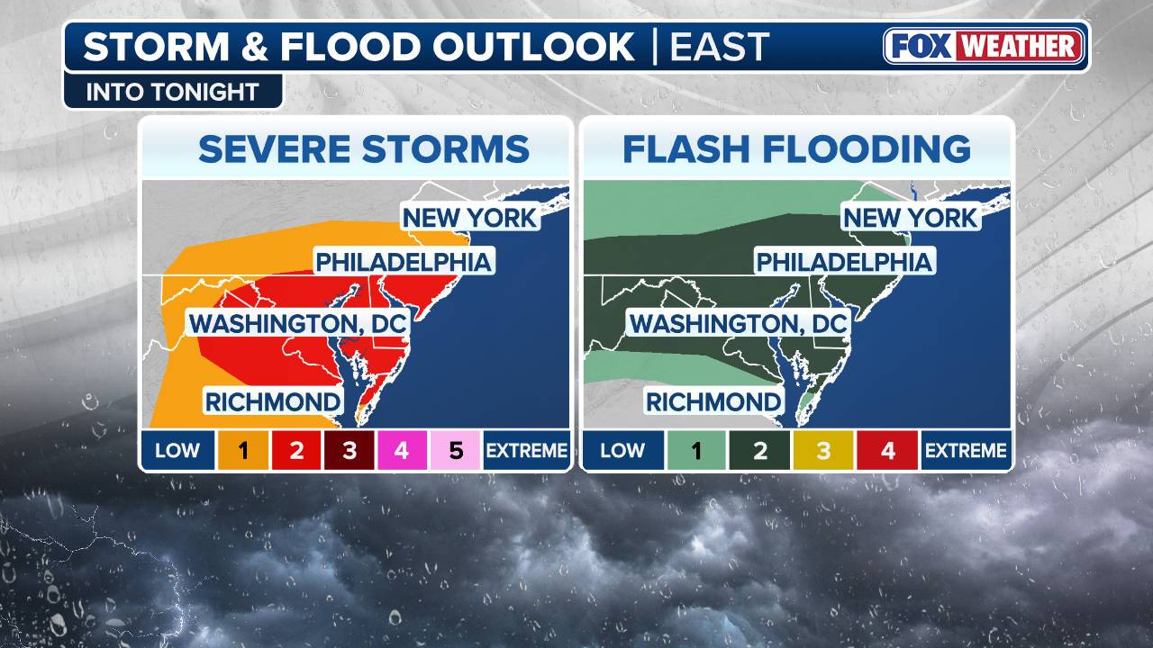
The DC region faces multiple rounds of showers and potentially severe storms with damaging winds and urban flash flooding risk; forecasters warned the threat could evolve and some storms may linger into Monday.
Severe storm threats are spreading across the eastern United States, reaching from the Carolinas to New Jersey and the Washington, D.C. area. The National Weather Service has issued multiple alerts warning of wind gusts up to 40 mph, flash flooding, and rapidly changing conditions, according to News Observer and The State.
Forecasters warn that some storms could linger into Monday. Residents in several states are being told to shelter indoors, stay off flooded roads, and keep a close eye on weather updates as conditions evolve quickly.
Carolinas Hit With 40 mph Gusts and Localized Flooding
The NWS office in Wilmington, NC issued alerts for several South Carolina counties, including Marlboro, Dillon, and Marion. Strong thunderstorms are producing wind gusts up to 40 mph, according to The State and Island Packet. Specific interstate stretches are under threat — including I-20 in SC between mile markers 126 and 141, and I-95 in SC between mile markers 146 and 163.
Torrential rainfall may cause localized flooding in low-lying areas. Counties in North Carolina — including Northampton, Hertford, and Bertie — are also affected. Doppler radar is tracking the storms. Downdrafts from thunderstorms can knock down tree limbs and send unsecured objects flying, Herald Sun reported.
Lehigh Valley Faces Flash Flood Risk Into Late Night
The Allentown, Pennsylvania area — including the Lehigh Valley — faces a slight risk of flash flooding from 7 p.m. to 2 a.m. Sunday night. Forecasters expect rainfall totals of a quarter to a half inch, with more possible overnight. The rain chance on Sunday sits at 80%, according to News Observer.
There is a silver lining: the rainfall is helping ease ongoing drought conditions in the region. Still, urban areas and spots with poor drainage are most at risk. Flash flooding can develop fast, giving residents little time to react.
Washington D.C. Braces for Multiple Rounds of Storms
The D.C. region faces several waves of showers and possibly severe storms. Forecasters warn of damaging winds and urban flash flooding. Some storms could stretch into Monday morning. Charlotte Observer noted that conditions may change rapidly, making it critical for residents to monitor local weather updates.
Urban areas are especially vulnerable to flash flooding because pavement and storm drains can quickly become overwhelmed. Forecasters stress that even a short, intense storm can cause dangerous flooding in city streets and underpasses.
Key Safety Steps Repeated Across All Storm Alerts
Every advisory across the affected regions shares the same core safety message. Go inside when lightning threatens. Stay away from corded phones and electrical equipment. Never drive through a flooded road — even shallow water can sweep away a vehicle, according to Island Packet and The State.
After the last thunder or lightning, wait at least 30 minutes before going back outside. Authorities stress that the danger does not end when the rain stops. Floodwaters can remain on roads long after a storm passes.
Sentiment
Mostly NegativePublishers
11
Articles
19
Reach
30