National heat and varied risks.
U.S. Heat Wave Intensifies with Extreme Temperatures, Flash Flood, and Fire Weather Risks
Anonymous
Key Points
1
In Baton Rouge, a Level 2 excessive rainfall risk is in effect for today into Tuesday, with about a 70% chance of showers and storms and potential heavy downpours, though there is currently no flood watch; a stalled front to the north and Gulf moisture will keep rain chances high before a drying trend returns later in the week.
2
In western North Carolina, a Flash Flood Watch is in effect for Yancey, Mitchell and McDowell counties through 8 p.m. as storms bring rainfall with embedded downpours capable of producing higher totals, potentially up to 3+ inches in the mountains.
3
In the Buffalo, NY area, Tuesday is expected to be the peak heat day with heat indices commonly in the mid- to upper-90s and possibly reaching 100+ in some areas; a Heat Advisory is in effect 11 a.m.–8 p.m. Tuesday, with relief arriving on Wednesday as a cold front moves through.
4
Nebraska will stay hot and dry under a strong high-pressure ridge, with daily highs approaching the upper 90s late in the week and heat indices around 100; rain chances remain below 5%, and UV exposure will be very high (UV index 9–10) with gusty winds (40–45 mph) possible Wednesday, elevating fire weather concerns especially in the northwestern part of the state.
5
In Pennsylvania, several central counties (Mifflin, Juniata, Perry, Dauphin and Lebanon) are under a heat advisory Tuesday from 11 a.m. to 8 p.m. with highs near the mid-90s and dew points in the upper 60s, producing heat index values around 100; a cooling trend is expected later in the week.
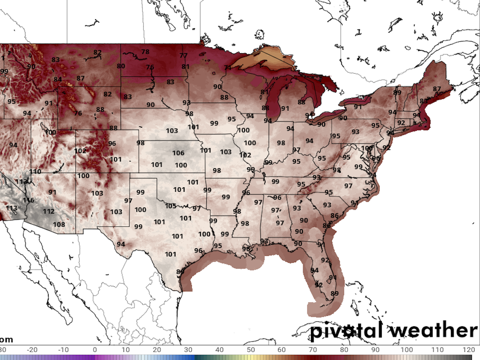
A powerful heat wave is spreading across the United States this week, pushing heat index values to 100°F or higher in states from Nebraska to Pennsylvania. The pattern shifts from wet and unsettled starts in the South and mid-Atlantic to hotter, drier conditions by mid-to-late week, according to WAFB and Fox Carolina.
Several states have already issued heat advisories. Flash flood watches are active in parts of North Carolina. And fire weather concerns are rising in Nebraska, where winds could hit 40–45 mph with almost no rain in sight.
Buffalo and Pennsylvania Bake Under Tuesday Heat Advisories
Tuesday is the peak heat day for much of the Northeast. In the Buffalo, New York area, a Heat Advisory runs from 11 a.m. to 8 p.m. Tuesday. Heat indices are expected to hit the mid- to upper-90s, with some spots potentially reaching 100°F or above. A cold front arrives Wednesday to bring relief, according to 3 News Now.
Pennsylvania is under the same Tuesday advisory window — 11 a.m. to 8 p.m. Five central counties are covered: Mifflin, Juniata, Perry, Dauphin, and Lebanon. Highs will be near the mid-90s. Dew points in the upper 60s will push heat index values close to 100°F. Cooler air returns later in the week.
Flash Floods Threaten North Carolina Mountain Counties
Western North Carolina faces a different kind of danger. A Flash Flood Watch is in effect through 8 p.m. for Yancey, Mitchell, and McDowell counties. Storms are expected to produce heavy downpours, with totals of 3 inches or more possible in the mountains, according to Fox Carolina.
The week in the Carolinas starts cool and unsettled before turning hot and humid by mid-to-late week. A backdoor cold front will offer brief relief before summer heat returns. Residents should watch for rapidly rising water in low-lying mountain areas early in the week.
Nebraska Faces Dangerous Dry Heat and Fire Weather Risk
Nebraska is heading into a prolonged stretch of dangerous heat. A strong high-pressure ridge is locking in hot, dry air. Daily highs will approach the upper 90s by late in the week. Heat indices will hover around 100°F. Rain chances stay below 5% through the forecast period, according to 3 News Now.
On Wednesday, winds could gust to 40–45 mph. The UV index will reach 9–10, which is classified as very high. Those two factors — dry air and gusty winds — raise serious fire weather concerns, especially in the northwestern part of the state. Residents should avoid outdoor burning and limit sun exposure.
Baton Rouge Soaked Now, Drier and Hotter Arrives Midweek
Baton Rouge is starting the week wet. A Level 2 excessive rainfall risk is in effect through Tuesday. There is a 70% chance of showers and thunderstorms each day, with heavy downpours possible. A stalled front to the north and Gulf moisture are fueling the rain. There is currently no flood watch in place, according to WAFB.
The wet stretch does not last long. Drier air pushes in by midweek. Once the humidity drops slightly and skies clear, temperatures will climb. The pattern mirrors what is happening across much of the country — a brief unsettled start giving way to a hotter, drier finish to the week.
Sentiment
Mostly NegativeNEGATIVENEUTRALPOSITIVE
Publishers
29
Articles
10
Reach
39
Topics
A
AnonymousAuthor


