Global Smoke and AI Monitoring
Wildfire smoke blankets North America while new AI rovers monitor forest floors.
Anonymous
Key Points
1
NOAA observed a remnant layer of light-to-moderate smoke over southern Greenland, moving eastward across the Atlantic Ocean.
2
NOAA said the U.S. smoke plume was concentrated primarily over North Dakota, Oklahoma and the Mississippi Valley, then moved across the Great Lakes, the Ohio and Tennessee valleys, the southeastern states and the Atlantic Ocean; some smoke also moved south into Texas and merged with smoke from Mexico.
3
The IBOC research review selected the eight papers through the Western Australia Bushfire Research Priorities framework, with the summaries intended for fire managers, partner organizations, decision-makers and the broader community.
4
TerraGuard’s Arduino Uno Q combines an STM32 real-time microcontroller with a Linux Debian application processor. The rover uses a four-wheel-drive chassis with 12.5-centimeter rubber tires and 20.5-centimeter track width to navigate roots, pinecones and gravel beneath the canopy.
5
TerraGuard places its AHT10 temperature-and-humidity sensor only a few centimeters above the forest floor to measure the microclimate where combustible needles and leaves dry, while reducing the influence of direct sunlight.
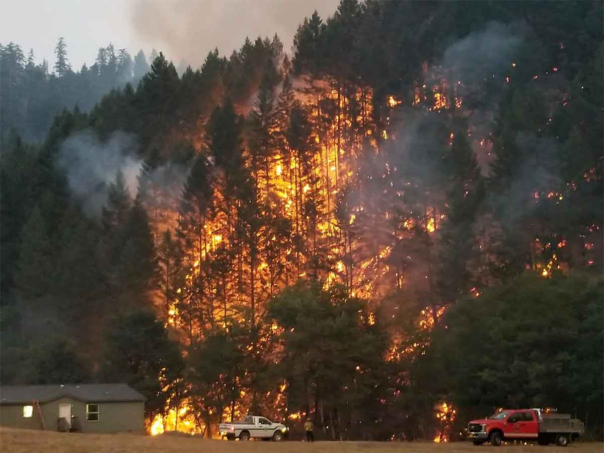
Wildfire smoke is blanketing large swaths of North America while Saharan dust spreads across the Caribbean, according to NOAA observations. Light to moderate smoke plumes stretch from Canada through the central and eastern United States, with some drifting into Mexico, Central America, and offshore into the Atlantic and Pacific oceans. Meanwhile, moderate Saharan dust covers much of the Caribbean and extends to the Yucatán Peninsula and Central America.
The smoke patterns reveal how wildfires and weather systems can move across entire continents. Scientists are also developing new tools to predict and prevent fires before they start, including autonomous rovers and satellite monitoring systems that help fire managers prepare for dangerous conditions.
Smoke Travels Across Three Continents and Oceans
NOAA detected smoke moving in multiple directions from North American wildfires. A layer of light-to-moderate smoke spread from southern Greenland eastward across the Atlantic Ocean. In the U.S., the main smoke plume concentrated over North Dakota, Oklahoma, and the Mississippi Valley, then pushed eastward across the Great Lakes and Ohio and Tennessee valleys before reaching the southeastern states and Atlantic coast.
Some smoke also moved south into Texas where it merged with plumes from Mexican wildfires. The Pacific Coast reported smoke impacts as well. This wide dispersal shows how smoke from North American fires can travel thousands of miles and affect air quality across multiple regions and countries.
Saharan Dust Blankets Caribbean Islands and Peninsula
Moderate-density Saharan dust is moving across much of the Caribbean region. The dust extends from the ocean eastward to the Yucatán Peninsula and into parts of Central America. This phenomenon occurs regularly when dust storms from the Sahara Desert travel thousands of miles westward across the Atlantic Ocean, affecting air quality and visibility across the region.
New Research Highlights Monitoring Tools and Fire Risks
Western Australia's Interagency Bushfire Operations Committee highlighted eight peer-reviewed studies published in late 2025. These studies focus on declining groundwater and streamflow, which affect fire risk, and satellite tools that track fire behavior in near-real time. The research was selected through the Western Australia Bushfire Research Priorities framework and designed to help fire managers and decision-makers prepare for dangerous conditions.
Autonomous Rover Detects Fire Risk Before Flames Start
The TerraGuard project uses a small autonomous rover to assess wildfire danger beneath forest canopies. Equipped with environmental sensors, GPS, and artificial intelligence, the rover navigates roots and pinecones on the forest floor to measure dry vegetation and other ignition risks. The rover places its temperature and humidity sensor just centimeters above the ground where leaves and needles dry fastest, giving fire managers early warning of dangerous conditions.
Sentiment
Mostly NegativeNEGATIVENEUTRALPOSITIVE
Publishers
60
Articles
31
Reach
91
Topics
A
AnonymousAuthor


