Rapid Fire Expansion
Summit Fire Expands to 1,300 Acres Near LA Border, Forcing Evacuations and Challenging Crews
Anonymous
Key Points
1
The Summit Fire crossed into the Angeles National Forest near Llano and had grown to about 1,300 acres by mid‑afternoon, with Cal Fire noting that access and terrain were hampering suppression efforts and increasing threats to structures.
2
In Antelope Valley, the fire reached about 309 acres within roughly an hour of ignition, indicating rapid growth and showing Angeles National Forest crews assisting the Los Angeles County Fire Department.
3
Officials had not yet confirmed road closures at the time of reporting, underscoring ongoing uncertainty about infrastructure impacts as the fire evolved.
4
Air support plans included a Very Large Airtanker (VLAT) plus three additional standard airtankers to reinforce lines, with no-divert rules in place to keep aircraft focused on the Summit Fire.
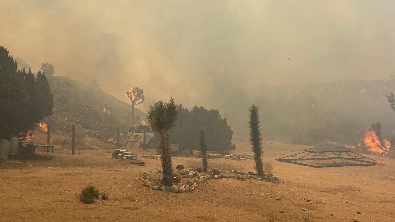
A fast-moving brush fire near the Los Angeles–San Bernardino border exploded from 8 acres to roughly 1,300 acres in just a few hours on July 10, threatening communities near Wrightwood and the Antelope Valley. Press Enterprise reported the Summit Fire is moving south-southeast and has forced evacuation orders across multiple zones as crews struggle with rugged terrain.
The fire started near Jesus Canyon Road and East Avenue Z before pushing into the Angeles National Forest near Llano. Containment figures have not been confirmed, and the cause of the fire remains unknown, according to Press Telegram.
Fire Races from 8 Acres to 1,300 in Hours
The Summit Fire ignited at 1:12 p.m. and reached 309 acres within roughly one hour. By around 3:30 p.m., it had grown to about 1,300 acres, according to Press Enterprise. That pace — more than 160 times its original size in under three hours — signals extreme fire behavior driven by dry conditions and difficult terrain.
Cal Fire noted that steep, hard-to-reach terrain was slowing suppression efforts and raising the threat to nearby structures. Head Top Topics reported the fire crossed into the Angeles National Forest, adding another layer of complexity to the response. Acreage reports fluctuated throughout the afternoon, reflecting how rapidly conditions were changing on the ground.
Evacuation Orders Cover Three Zones Near Wrightwood
Officials issued evacuation orders and warnings for zones LAC-E107, LAC-E127-C, and LAC-E1340. Residents in those areas were urged to leave immediately or be ready to go at a moment's notice. Press Telegram reported the fire is threatening both Los Angeles and San Bernardino counties, with officials still assessing infrastructure impacts.
Road closures had not been confirmed at the time of reporting. That uncertainty left some residents unsure of safe exit routes. Authorities asked the public to monitor local alerts closely and not wait for a final order before preparing to leave.
Air Tankers and Multi-Agency Crews Join the Fight
The Los Angeles County Fire Department led the response, with Angeles National Forest crews providing direct support. Additional firefighters from both Los Angeles and San Bernardino counties were arriving on scene throughout the afternoon, according to USA Today.
Air support was a key part of the strategy. Officials requested a Very Large Airtanker — a massive plane capable of dropping thousands of gallons of retardant — plus three additional standard airtankers. A no-divert order was placed on all aircraft, meaning the planes had to stay focused on the Summit Fire and could not be pulled to other incidents. Air operations were actively working to reinforce fire lines as the blaze continued to grow.
Cause Unknown as Fire Remains Fully Active
Investigators have not identified what started the Summit Fire. San Luis Obispo Tribune noted that the cause of the fire remains undetermined, a common early finding in fast-developing wildfire incidents. No injuries or confirmed structure losses had been reported at the time of the latest updates.
The fire's quick growth and uncertain containment status made this one of the more serious wildfire events in the region this season. Crews were expected to work through the evening to establish control lines before overnight winds could further complicate conditions.
Sentiment
Mostly NegativeNEGATIVENEUTRALPOSITIVE
Publishers
19
Articles
87
Reach
106
Topics
A
AnonymousAuthor


