Skaergaard Milestones
Greenland Mines Achieves Dual Milestones at Skaergaard Project: Bathymetric Survey and Initial Drilling Complete
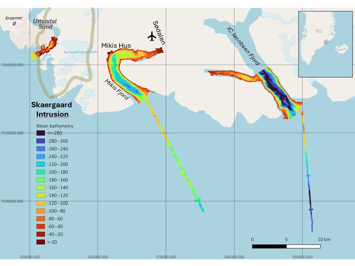
Greenland Mines Ltd has hit two major milestones at its Skaergaard Project in southeast Greenland, completing its 2026 bathymetric survey and wrapping up the initial phase of metallurgical core drilling, according to Clinton News Record. The survey used a multibeam bathymeter system aboard the vessel M/V Byr and covered more ground than originally planned.
The back-to-back achievements mark a significant push forward for the project, which targets a mineralized zone along Greenland's remote southeastern coast. The company says the data collected will directly support shipping infrastructure planning for the next development phase, Ottawa Sun reported.
Seabed Survey Covers More Ground Than Planned
The 2026 bathymetric survey gave Greenland Mines high-resolution data of the seabed near the Skaergaard site. That data allowed the support vessel Argus to anchor safely within 500 meters of the western mineralized zone, according to Fort Saskatchewan Record. Getting a vessel that close matters — it cuts costs and speeds up operations on a coast with little existing infrastructure.
The survey covered a larger area than originally scoped. Greenland Mines says the findings are now being used to support official navigational charting. The company will also commission a dedicated navigational safety study based on the results, Stratford Beacon Herald reported.
Core Drilling Shifts to Smaller NQ-Size Equipment
On the drilling side, Greenland Mines completed its initial run of HQ drill core. HQ core is a larger-diameter rock sample used to build a bulk metallurgical sample — essentially a test batch used to study how well ore can be processed. That phase is now done, Clinton News Record reported.
The program has since shifted to NQ-size core drilling, which uses a narrower drill bit. A fully operational core shack — a field facility where drill samples are logged and stored — is now up and running at the site. The transition signals the project is moving deeper into its technical testing phase.
Skaergaard Project Eyes Next Development Phase
Skaergaard sits in one of the world's most remote mining regions. The project targets a layered igneous intrusion known for hosting gold, platinum-group metals, and palladium. Getting reliable seabed and shipping data is critical before any large-scale development can begin, according to Ottawa Sun.
The bathymetric data will feed directly into future shipping and port infrastructure planning. With both the survey and initial drilling now complete, Greenland Mines appears to be positioning for a more intensive development push. The navigational safety study, once commissioned, will be a key document for regulators and logistics planners, Stratford Beacon Herald reported.
Sentiment
NeutralPublishers
4
Articles
4
Reach
4


