Severe Storm and Flood Threat
Severe Thunderstorms and Flash Flooding Threaten Nebraska and Iowa With Damaging Winds
Anonymous
Key Points
1
A Severe Thunderstorm Watch was issued for south-central and southeastern Nebraska through 10 p.m. Monday, with forecasts calling for isolated hail up to 1.5 inches and damaging wind gusts as high as 80 mph.
2
Some Nebraska locations had already received more than an inch of rain by Monday morning, adding to the overnight flash-flood risk as storms could repeatedly move over the same areas.
3
National Weather Service meteorologist Clint Aegerter said the severity of Monday’s storms would depend partly on how much the morning cloud cover clears and when that occurs: “It depends on how much it clears out and the timing of that.”
4
The Omaha area could see a rain chance near 90% from Tuesday night into Wednesday, while forecasters put additional rain chances later in the week at roughly 30% to 40%; Aegerter said any later severe weather was not expected to be particularly high-end.
5
Central Iowa storms on Monday produced hail, with residents submitting photos and videos of the weather to local media.
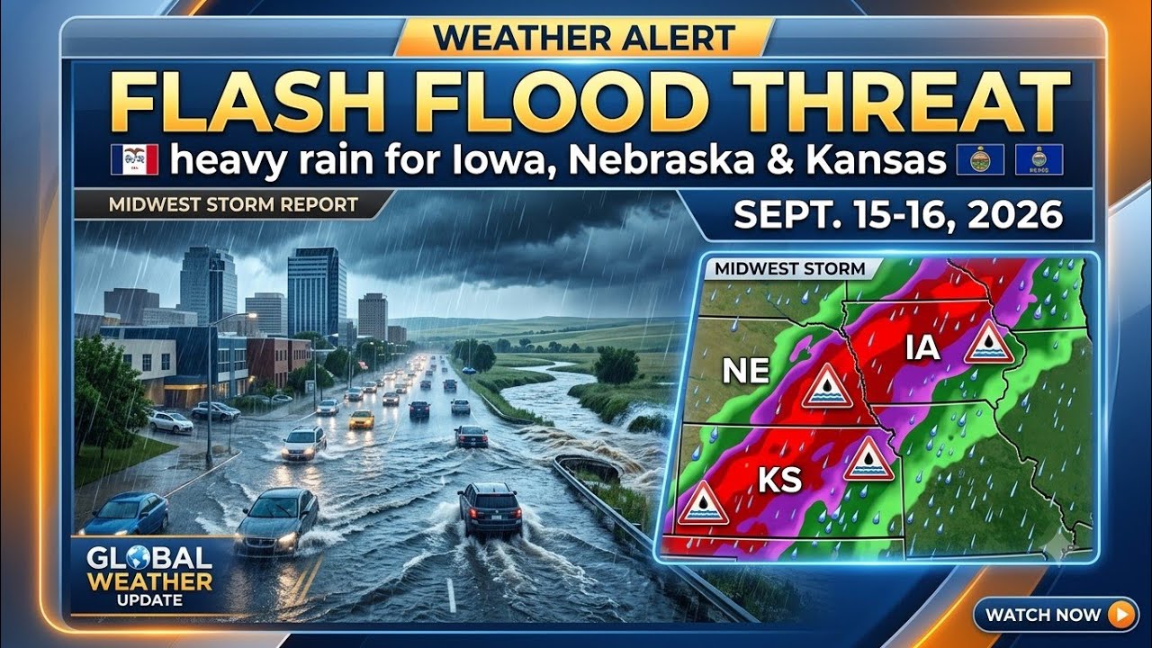
Severe thunderstorms will pound eastern Nebraska and Iowa on Monday afternoon and evening, bringing the threat of damaging winds up to 80 mph, large hail, and strong tornadoes between 5 p.m. and 10 p.m., according to National Weather Service. Training rain—where storms repeatedly move over the same areas—could trigger flash flooding in the Lincoln and Omaha regions, with some Nebraska locations already soaked by more than an inch of rain by Monday morning.
The danger stems from a cold front pushing through warm, humid air, creating unstable atmospheric conditions. After the storms organize overnight, cooler weather will settle in across Nebraska, with temperatures dropping into the upper 60s and 70s and additional rain chances continuing through much of the week, National Weather Service meteorologist Clint Aegerter said.
Isolated Supercells Could Produce Extreme Damage Monday Evening
A Severe Thunderstorm Watch covers south-central and southeastern Nebraska through 10 p.m. Monday, with forecasters calling for isolated hail up to 1.5 inches and damaging wind gusts as high as 80 mph, according to National Weather Service. The most critical window runs from 5 p.m. to 10 p.m., when isolated supercells—rotating thunderstorms with extreme updrafts—could spawn strong tornadoes alongside the hail and wind.
Storm intensity will hinge partly on cloud cover timing. "It depends on how much it clears out and the timing of that," Aegerter said. Clear skies allow more solar heating, fueling stronger updrafts and more unstable air. If morning clouds linger, the atmosphere may not destabilize enough for the worst-case scenario.
Flash Flooding Risk Intensifies With Repeated Storm Movement
Some Nebraska locations had already received more than an inch of rain by Monday morning, adding to overnight flash-flood risk. Flood watches remain in effect for Lincoln, Omaha, and parts of southeastern Nebraska as storms could repeatedly drench the same areas—a process called training that can dump 2 to 3 inches or more in vulnerable spots.
The Omaha area faces a rain chance near 90% from Tuesday night into Wednesday, according to National Weather Service forecasts. Soils and drainage systems already stressed by Monday's rain will struggle to handle additional moisture, keeping flood risk elevated even after the severe wind and tornado threat passes.
Central Iowa Storms Already Producing Hail; Northern Regions Face Heavy Rain
Central Iowa experienced hail from Monday storms, with residents submitting photos and videos to local media, according to KCCI. Northern Iowa also faces the threat of heavy rain and possible severe storms, though tornado potential remains lower than in eastern Nebraska due to different moisture and temperature profiles across the region.
After Monday's storms clear, cooler air will dominate Nebraska and Iowa through the week. Additional rain chances hover at 30% to 40% later in the week, but forecasters do not expect any later severe weather to be particularly intense or widespread, National Weather Service meteorologist Clint Aegerter said.
Sentiment
Mostly NegativeNEGATIVENEUTRALPOSITIVE
Publishers
21
Articles
21
Reach
42
A
AnonymousAuthor


