Heatwave, Bertha Alerts
Dangerous Heat Continues Through Wednesday as Tropical Storm Bertha Nears Gulf Coast
Anonymous
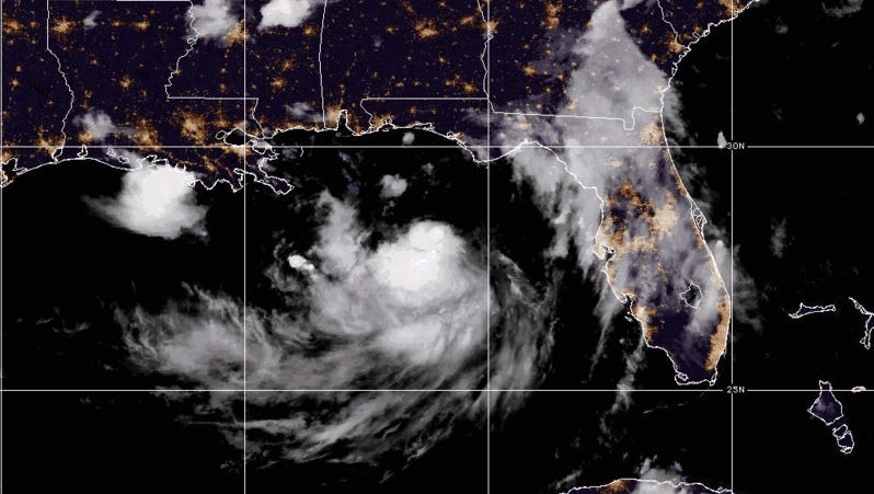
A dangerous heat emergency is gripping parts of the Gulf Coast, with heat index values expected to top 105 degrees through Wednesday, according to WBRC. Forecasters have declared today and Wednesday First Alert Weather Days — a warning that conditions are serious enough to cause heat-related illness, especially for anyone spending time outdoors.
At the same time, Tropical Storm Bertha is churning through the Gulf and targeting the Alabama, Mississippi, and southeastern Louisiana coastlines. A Storm Surge Watch is in effect for those areas, where life-threatening flooding from storm surge is possible, WBRC reports.
Heat Index Above 105 Degrees Threatens Gulf Coast Residents
A Heat Advisory is currently in effect and could be extended through Wednesday evening. The high humidity is the main danger. It makes the air feel far hotter than the thermometer reads, pushing the "feels like" temperature well above 105 degrees at the hottest part of the day, WBRC says. That level of heat can quickly become dangerous.
Health officials warn that heat illness can strike fast, especially for children, the elderly, and outdoor workers. Staying hydrated, finding air conditioning, and limiting time outside during peak afternoon hours are the key steps to stay safe. Relief is coming — by Thursday, highs should drop back to a more seasonal 91 degrees, according to WBRC.
Tropical Storm Bertha Strengthening But Not Expected to Become Hurricane
Tropical Storm Bertha is gaining strength in the Gulf of Mexico, but forecasters do not expect it to reach hurricane status. Strong wind shear — fast-moving upper-level winds that tear storms apart — is holding it back, according to Palm Beach Post. Still, the storm is dangerous. It is expected to bring heavy rain, gusty winds, and storm surge to coastal areas.
Tropical storm conditions are forecast to hit parts of the Gulf Coast from Alabama west into southeastern Louisiana. A Storm Surge Watch covers the Alabama, Mississippi, and southeastern Louisiana shorelines, WBRC reports. Storm surge — seawater pushed onto land by storm winds — can be life-threatening even from a weaker tropical storm.
Florida Faces Rain and Surge Risk But Avoids the Worst
Florida is not in the direct path of Bertha's core, but the state is not entirely in the clear. The Ledger and other Florida outlets report that the storm will bring storm surge, gusty winds, and heavy rain to parts of the state. Coastal flooding and rough surf are the main concerns for Florida residents.
Forecasters are watching whether wind shear weakens enough to let Bertha intensify before landfall. For now, the consensus is that it stays a tropical storm, TCPalm reports. Even so, residents along the Gulf Coast and in Florida should monitor local forecasts closely and have a plan ready if conditions change quickly.
Storm Threat Continues Into Thursday With Flood Risk From Frontal Storms
The weather trouble does not end with Bertha. A cold front is expected to sweep through the region by Thursday, touching off scattered afternoon thunderstorms, WBRC says. Some of those storms could drop heavy rain in a short time, creating an isolated flood threat for areas already saturated by Bertha's rain.
After Thursday's front passes, conditions should improve. Afternoon highs are expected to settle near 91 degrees — still warm, but a noticeable step down from the dangerous heat of today and Wednesday. Forecasters will continue to update the outlook as both Bertha and the front develop.
Sentiment
NeutralNEGATIVENEUTRALPOSITIVE
Publishers
9
Articles
7
Reach
9
Topics
A
AnonymousAuthor


